Update:
The Pavilion at Lemay (PAL) is a community center and aquatic center. It is beautifully designed to help fulfill your health and recreational needds. It offers exercise facilites for the entire family including a large gym, weight room, indoor running track, showers, etc.... In the summer their pool and lazy river are community favorities. PAL also has community rooms where groups may schedule meetings or hold parties. For more information about this gorgeous facility call 314-615-8877.
Reconnaissance: noun, 1. military observation of a region to locate an enemy or ascertain strategic features. 2. Preliminary surveying or research.
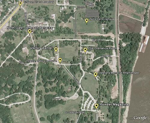
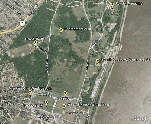
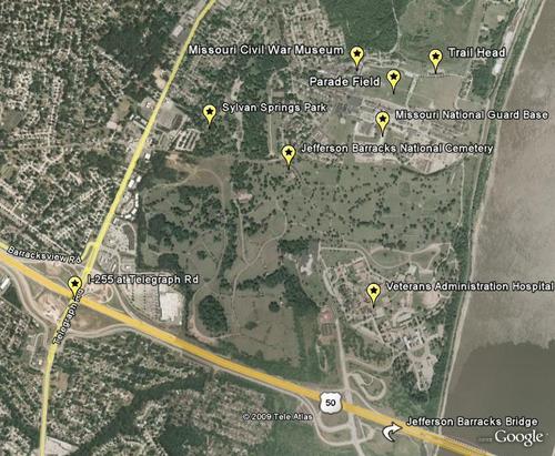
The maps depict areas within Jefferson Barracks Park and the areas that encompassed the former Jefferson Barracks military reservation.
This map shows the main areas of Jefferson Barracks Park which is one of over 70 St. Louis County Parks.
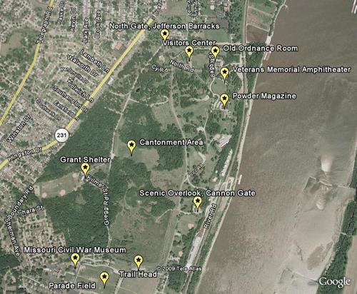
This map shows the Historic Sites area of Jefferson Barracks Park. The 130 acres east of Grant Road were gifted to St. Louis County by the Federal Government to be used only as a monument in recognition of the history of Jefferson Barracks and for use as museums. It is dedicated to honor the mean and women who served and lived here, whether military or civilian.
This map shows the area of Jefferson Barracks Park south of the Historic Sites area and north of the National Guard Base. Note that the location marked "Grant Shelter" is now the location for the Pavilion at Lemay.
This map shows the area to the south of Jefferson Barracks Park that includes the Veterans Administration Hospital, Jefferson Barracks National Cemetery, and Sylvan Springs Park. Sylvan Springs was the area of the original military reservation. It served as a park and recreation area for troops throughout its history. The Beverage Garden, established in 1939, is still there. The Beverage Garden site is the location where Stephan Watts Kearny and the first troops from the United States Army camped when they took possesion of the grounds that were to become Jefferson Barracks.They arrived on July 10, 1826.
Related St. Louis County MiIlitary Historic Sites.
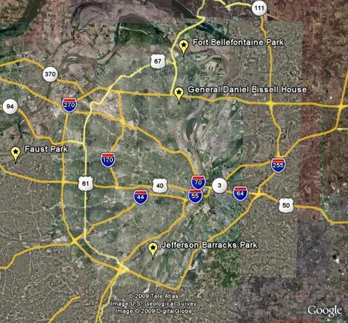
This map shows where the the General Daniel Bissell House and Fort Belle Fontaine are located in North St. Louis County in relation to Jefferson Barracks. The Bissell House was built by Daniel Bissell in 1812, before he left St. Louis to command US troops in Canada during the War of 1812. His family maintaineed the property until it was donateed to St. Louis County Parks in the early 1960 to be used as a historic site and museum. Fort Belle Fontaine was built in 1805. It was the first United States fort west of the Mississippi River. It included a faciltiy referred to as an "Indian Factory", which was a trading post that provided trade goods to Native Americans that held treaties with the United States. Many well known explorers of the west used Fort Belle Fontaine as their starting point such as Stephan Long, Zebulon Pike and Henry Atkinson. Lewis and Clark stopped at the site on their first night of their legendary journey and they stopped at the new fort on their return in 1806 before entering St. Louis. The Fort's mission was largely replaced when Jefferson Barracks was established in 1826 but was not abandoned by the army until 1833. The Missouri Hill Home, once owned by the City of St. Louis, was constructed at the site in 1916. It is currently operated by the State of Missouri's Division of Youth Services. Both the Bissell House and Fort Belle Fontaine are available to be visited by the public. The Fort site is opened year round from sunrise to sunset but may be closed for special events or maintenance. It features a 3-mile loop trail through an upland prairie, along Coldwater creek and along the Missouri River. A visit will provide an opportunity to see the Works Progress Administration era ruins that were built as a resort in 1939. The Bissell House may be visited with advance reservations. Call 314-615-8800 for information.
